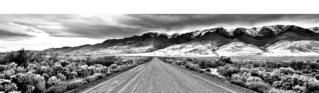
The majestic Eagle Cap Wilderness of Northeastern Oregon outside of the town of Joseph Oregon is a well-known destination for backpacking and photography enthusiasts. I recently returned from a 3-day backpacking trip with my brother. The hike began at the Wallowa Lake Trailhead and continued to Horseshoe Lake and Moccasin Lake in the Lake Basin region for a total of 28 miles hiked with our 45-pound backpacks. 
The Eagle Cap Wilderness lies in the heart of the Wallow Mountains in the Wallowa-Whitman National Forest and totals an amazing 350,461 acres of wilderness. The Eagle Cap Wilderness is known for its high alpine lakes and granite peaks and ridges. The 6th highest peak in Oregon, Sacajawea Peak at 9838 feet is home here. According to the US Forest Service, hikers can choose from approximately 534 miles of hiking trails in the Eagle Cap. Trailheads are located on all sides of the wilderness, with access from the counties of Wallowa, Union, and Baker. Due to heavy winter snowfall, the area typically does not open until late summer and fall.
The most popular hiking area in the Eagle Cap Wilderness is the Lakes Basin Management Area and this is where we were headed on our hike as it offers the most spectacular views of the scenic alpine terrain and granite peaks. The basin is home to numerous alpine lakes such as Horseshoe, Unit, Lily, Razz, Lee, Douglas, Crescent, Moccasin, Mirror, Sunshine, Pocket, and Glacier. With all of them known for their beauty, we chose the destinations of Horseshoe Lake and Moccasin Lake for our hiking trip.
The hike to Horseshoe Lake started at the Wallowa Lake Trailhead on the West Fork Wallowa River Trail #1820. The trail begins at the right of the trailhead message board starting at an elevation of 4645 feet and climbs steadily 905 feet for 2.8 miles where you reach the junction to the trail for Ice Lake. At this point you can head up to Ice Lake for another 4.7 miles and 2300 foot gain or just continue on the main West Fork Wallowa River Trail for another 3.3 miles and 490 foot gain until you reach the aptly named Six Mile Meadow at an elevation of 6040 feet. So far you will have hiked 6.1 miles over a very modest gain of 1300 feet. These 6.1 miles cover a rather rough and rocky terrain. Also, you need to maneuver around countless piles of horse crap as these trails are also traveled by people who would prefer to use horses where others prefer to use their own feet.
So far we hiked 6.1 miles from the Wallowa Lake Trailhead to Six Mile Meadow and have another 3.1 miles and an elevation of gain of 1095 feet before reaching Horseshoe Lake. At the junction for Six Mile Meadow you are now on trail #1810. At Six Mile Meadow, it gets a little bit tricky. At two points you cross the West Fork Wallowa River, however both hiker footbridges are washed out (one sign said the bridge was out since 6/24/05) and there are a couple of logs across the river that you need to gracefully and carefully use to cross the river. It isn’t a big deal, but we did need to stop and think about where and how to make the crossing. Once you cross the second point of the river, you can easily pick up the trail again and continue through the meadow a short distance where you will now begin to climb up the trail to reach Horseshoe Lake, which at this point, is approximately 3 miles up and a few switchbacks away. The trail is very rough and rocky and as it was early in the season we had approximately 10 trees which had fallen across the trail and we had to climb over and with a 40-pound pack, this does take its toll on you. Once you are done climbing up the trail you can finally catch a glimpse of Horseshoe Lake and near here you will reach a junction. To the right, trail #1810 (which you have been on) veers to the right where you can bypass Horseshoe and head to Unit or Razz Lake. However, if you want to continue to Horseshoe, veer left (you will be on trail #1821 now) and after about a quarter of a mile of hiking along the right side of the lake you can select the perfect campsite and finally relax and enjoy the views at 7135 feet. It took us approximately 6 hours to hike the 9.1 miles up to Horseshoe Lake, including a couple of breathers and lunch.
After an evening of battling the countless mosquitoes and watching the fish jump, we woke up the next day and decided to take a day hike to Moccasin Lake which is 3.3 miles from Horseshoe and takes you through the beauty of the Lakes Basin. From Horseshoe Lake, you can easily pick up the main hiking trail again where in a short distance you reach Lee Lake which is in on your left. As you continue along the trail you begin to climb up steadily rocky terrain for 1.3 miles where you reach another junction. At this point you can veer right and take trail #1810 to the back-side of Douglas Lake and then further on to Crescent Lake, or you can veer left like we did and hike along Douglas Lake on trail #1810A for another 2 miles until you reach Moccasin Lake.
 Moccasin Lake, at 7475 feet, represents the beauty of when I think of a high elevation alpine lake. It is a gorgeous pool and for a photographer, it has all the aspects one could want, high snow-capped peaks, clear blue water, and abundant vegetation and wildlife. The water is pristine and it is surrounded by majestic granite peaks including a close-up view of the namesake of the area, Eagle Cap. At a junction beside Moccasin Lake, you can turn left across a scenic isthmus between the lakes two parts where you see a sign to Glacier Pass. This will take you to Glacier Lake if you choose. The trail climbs 2.7 miles and gains 1100 feet through Glacier Pass and then down a short distance to Glacier Lake. From Glacier you can continue the loop back to your car at the Wallowa Lake Trailhead, but it is a 12 mile hike which you can break up by either staying at Frazier Lake or Six Mile Meadow.
We decided that after visiting Moccasin Lake for a few hours and enjoying the scenery, we would hike back the 3.3 miles to Horseshoe Lake where we saw that our original campsite close to the water was still available. We spent the night and then woke up at 6:00 AM to hike the 9.1 miles back to our car at the Wallowa Lake Trailhead. I believe the 9.1 miles back took about 5 hours including a break for a quick lunch.
I would say that during the time we were hiking, the trails were in rougher shape that in the previous time I backpacked in the area. Due to the late snowmelt things just opened up a few weeks ago. There are about 20-25 large trees which have fallen across the trails that you need to maneuver over, under, or around and that does add to the toll after a while. There was also what appears to be a landslide along the way to Six Mile Meadow with quite a bit of debris and logs to maneuver around, however it looks like the Forest Service was up there with chainsaws to clear the way. The hiking trail itself is very rocky but it is also clear and we had no trouble finding our way. There are hardly any signs letting you know which trail you are on, or where one junction leads to another; it is really up to you and a good map to know where to go. Also, I refer to trail numbers such as #1820, #1810 etc, however, I do not remember seeing any of the trails numbered or marked in any manner while hiking. We just had a map from a hiking book and did not have trouble figuring out which hiking trails to take or where to head; so once again, we did not have trouble finding our way and we felt confident in where we were headed.
We didn’t think it was too crowded when we were up there. There were maybe 5 people camping at Horseshoe Lake and I would say that the whole time we were on trail we passed maybe just a dozen people at most. Certainly there are times when there are more hikers and campers, and times when there are fewer, but regardless, the Eagle Cap Wilderness is a vast and expansive place and nobody should have trouble finding solitude. In my opinion, there is nowhere else in Oregon that has this level of pristine and majestic beauty. Everywhere you look there is an 8500 foot peak, or a clear alpine pool. It is simply an amazing place to experience, and Oregonians are fortunate to have it in our state. Although, for Portlanders, it is a grueling 6-hour drive to get to the trailhead, not to mention the countless hours on foot hiking. Yet it is the work and the effort to get to the destination that makes this place special and unique. Any of the hiking trails in the Eagle Cap Wilderness would be considered a top Oregon hiking and photography destination as they all either lead to a glorious alpine lake or up a majestic peak. I encourage you to explore Oregon and make your own adventure.
To Get There:
From Portland, Drive on Interstate 84 to La Grande exit 261. Take Highway 82 and follow the Wallowa Lake signs through Enterprise and Joseph. While on Highway 82 you reach Wallowa Lake and stay on this road until you reach the end of the road with the Wallowa Lake Trailhead on your left for a total of 335 miles. There is a picnic spot and public restrooms in the parking area. A Northwest Forest Pass is required to park. At the trailhead there is a self-registration box for your camping trip, which is free.
There are countless regulations for the Eagle Cap Wilderness to protect its fragile beauty so please check with the US Forest Service for current regulations and also check on trail conditions and current issues that you need to be aware of for a safe trip.

Oregon Photo Guide™ features the landscape photography of Michael Skourtes, Bend Oregon photographer and avid outdoorsman. I venture throughout the state searching for the top destinations for Oregon hiking, backpacking, camping, and photography. I share my experiences and photography of Oregon on my guide. I encourage you to explore Oregon and make your own outdoor adventure.