
Leslie Gulch, in remote southeastern Oregon, is a top destination for outdoor enthusiasts seeking towering and colorful geological formations.  The area encompasses more than 11,000 acres highlighted by the Leslie, Timber, Slocum, Juniper, Dago, and Runaway gulches managed by the Bureau of Land Management as an area of Critical Environmental Concern to protect the outstanding landscape scenery and habitat of California bighorn sheep and several rare and endangered plant species.
The expansive Leslie Gulch land has a rich history dating back 5,000 years when Native Americans hunted and fished along the Owyhee River, tributary canyons, and adjacent lands. Leslie Gulch gets its name from an event in 1882; where a cattle rancher, Hiram E. Leslie, was struck by lightning while working in what was then known as Dugout Gulch. The original Leslie Gulch Canyon Road long served as a wagon and mail route between Rockville and Watson. More recently, California bighorn sheep were reintroduced into Leslie Gulch, with a small herd of 17 animals in 1965. Over the years, the herd has expanded to over 200. Mule deer and Rocky Mountain elk are also found in the area. The rugged canyons also provide habitat for coyote, bobcat, and a variety of non-game migratory birds, and upland game birds such as chukar, a type of partridge, and California quail.
The most striking feature of the Leslie Gulch area is its impressive geological formations formed by violent volcanic eruptions.  Many of the molten flows cooled and lithified into rock, and gases were trapped forming the pitted, “honeycomb” appearance of many of the geological formations. Additionally, subsequent weathering during the last 15.5 million years has eroded and reshaped the terrain into the current landscape. Today, the stunning scenery displays beautifully steep slopes of honeycombed towers, sheer pinnacle cliffs, and deep side-pocket canyons with brilliant colors highlighted by mineral deposits and the volcanic ash of this ancient caldera.
Recreational activities include hiking, boating, fishing, plant and wildlife viewing, and photography. A boat ramp in Leslie Gulch provides access to the expansive Owyhee Reservoir, a 53-mile lake formed by the damming of the Owyhee River. This man-made body of water known as Lake Owyhee, which is the longest in Oregon, offers prime high desert scenery with the Owyhee Mountains to the east. The only camping allowed is near this boat ramp at Slocum Creek campground with 12 tent sites, picnic tables, and a vault toilet. But do not let these amenities fool you into thinking you are in store for a cushy retreat. 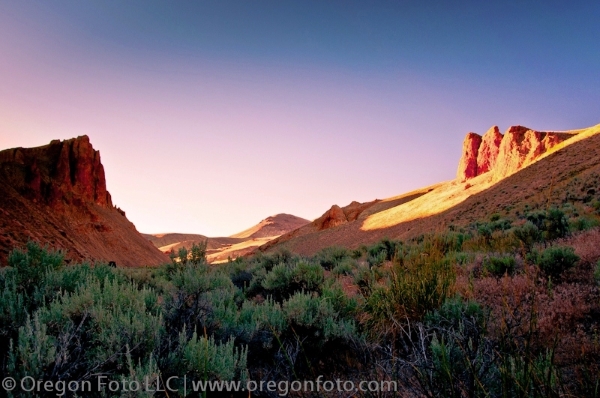 This is a barren gravel road area with no electricity, cell service, drinking water, or shade. The climate of the area is similar to that of the Great Basin and is one of extremes. Winter low temperatures can range well below zero, but typically are between 10 and 30 degrees. Temperatures in the summer are easily over 100 degrees and the area is barren desert-like in the most remote portion of Oregon. Shade is literally nowhere to be found in this area as there are neither significant trees nor man-made structures. In the evenings, you can be the only person around for miles and have the place all to yourself. Your only source of supplies and protection are from what you plan and bring for the trip; a call for help can be unanswered.
A highlight of the Leslie Gulch area is the opportunity to explore and hike the zigzagging side gulches. One of the most impressive gulches is Timber Gulch.  The start of the hiking trail to this gulch is not marked, but you can find it by either driving 2.35 miles up from Slocum Creek campground or by driving down 1.25 miles from the Juniper Gulch sign. The hike is just 0.6 miles and up the dry creek bed of Leslie Creek, veering through sandy washes, silver-tipped sage brushes, and through the tight and narrow canyon walls. After scrambling over and under boulders, you reach a large amphitheater-like area wrapped by canyon walls and a wide-open view down the gulch. The view is remarkable, and a great spot to eagerly wait for the perfect light of sunset with camera gear to take pictures.
Another recommended gulch to explore is Dago Gulch which is located up the Leslie Gulch road 2.25 miles from Timber Gulch where you can park next to a locked green gate. 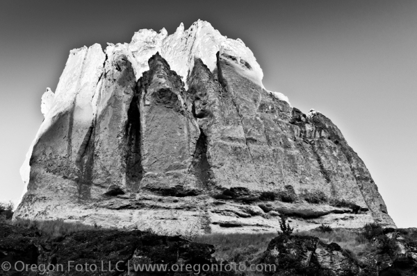 The hike is up the closed road where you can travel 0.8 miles where you reach a cattle gate and cannot go any further as it becomes private land. Along this dusty road there are abundant photo opportunities and you can find yourself walking a few hundred feet at time and stopping to take photographs as the scenery progresses into a view back of the towering and sheer upright canyon walls from where the hike begins. One side of the gulch is relatively smooth with white, red, and green volcanic ash and a colossal and lone pinnacle anchoring the area, whereas the other side is filled with honey-combed pockets of spires and sheer cliffs weathered and carved into intricate stone lacework due to the passing of time. Dago Gulch during sunsets is a top location to take photographs and capture the dimming light and the dark shadows the sun creates against the white rock face of this sheer canyon side.
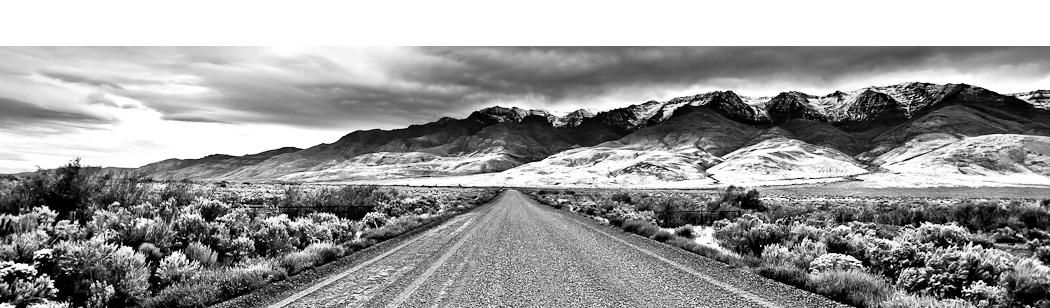
There are no fees to neither enter nor stay at Leslie Gulch as this is BLM land. The drive to Leslie Gulch could be a destination all its own with fantastic scenery of rolling hills, open plains, rocky outcroppings, and magnificent cliffs. 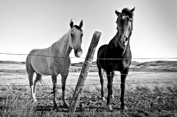 There are a few farms and ranches scattered throughout the area with opportunity to photograph ranching life. The landscape is complete with horses and ranching lifestyle that is reminiscent of the ranching community that came to this area decades ago and helped shape the economy and culture of Oregon. Once you enter the Leslie Gulch area (noted by the sign), it is easy to find your way as there is only one road in and one road out. During rains, the dirt & gravel road becomes difficult to navigate, so be prepared.
Truly a premier destination for Oregon hiking and photography, Leslie Gulch is more impressive than many State Parks and deserves protection for its fragile environment. Yet its remoteness is likely what has preserved its fragile beauty and keeps it a lesser-known jewel for those seeking solitude.
To Get There:
From Jordan Valley, take US Highway 95 north for 27 miles and take a left at the sign for Succor Creek for 8.5 miles on gravel road. You will come to a T-shaped junction where you turn left toward Succor Creek for 1.8 miles further until you see a BLM sign for Leslie Gulch. This is the entrance to the area and the only road is Leslie Gulch road which winds down approximately 15 miles to the boat ramp at Owyhee Reservoir. The road is rough, and although I saw passenger cars while on my trip, a 4-wheel drive vehicle is recommended.
For perspective, Leslie Gulch is 493 miles from Portland, Oregon.

Oregon Photo Guide features the landscape photography of Michael Skourtes, Bend Oregon photographer and avid outdoorsman. I venture throughout the state searching for the top destinations for Oregon hiking, backpacking, camping, and photography. I share my experiences and photography of Oregon on my guide. I encourage you to explore Oregon and make your own outdoor adventure.