Lost Lake in Hood River County, Oregon is located just ten miles northwest of Mt. Hood within the heart of Mt. Hood’s beauty and scenic grandeur.  While Oregon may have at least 19 areas named “Lost Lake,” this is the one droves of visitors always seem to find. With a famed “postcard” view of Mt. Hood’s northwest face reflected in its waters, the proximity and view of the mountain from Lost Lake is unrivaled, making it one of the most photographed locations in Oregon. An amber glow of Mt. Hood’s snowfields and the evening reflection of Mt. Hood in the cool still water of the lake is the reason why photographers make this trek. Oregon hikers and nature enthusiasts come to the area to view the mountain and surrounding water, old-growth forests, wildflowers, and diverse wildlife habitat and viewing opportunities.
Mt. Hood is the highest mountain in Oregon. It also ranks as the 4th highest in the string of Cascade Mountain Range volcanoes that stretch from Mt. Garibaldi in British Columbia south to Mt. Lassen in Northern California. The snow-fed Lost Lake at 3,100 feet in elevation and with a perimeter measuring 3.4 miles is surrounded by the vast Mt. Hood National Forest which encompasses 1.2 million acres and over 1200 miles of hiking trails.  At 167 feet deep, Lost Lake is the second-deepest body of water in the Mt. Hood National Forest after Wathum Lake at 177 feet. The lake is bounded on the east by 4,468 ft Lost Lake Butte and on the southwest by 4,556 ft Preachers Peak. Lost Lake is fed by three unnamed intermittent creeks from Lost Lake Butte, and Inlet Creek from Preachers Peak. The lake maintains a highly consistent level via an outlet at the north tip from the source of Lake Branch Hood River. The surrounding area is home to several threatened species and has been targeted by conservation groups for wilderness protection. The area is also part of the proposed Lewis and Clark Mount Hood Wilderness which would prevent development, logging, mining, and possibly require the removal of structures and roads.
Lost Lake is privately owned and the Lost Lake Resort offers 120 RV and tent camp sites on a “first-come first-serve” basis. The camping sites are quite large and well-spaced, with impressive giant Douglas Firs, White Pines, Cedars, and Mountain Hemlocks throughout that provide remarkable seclusion considering the number of sites available in the campground. Swimming, canoeing, kayaking, and boating, are allowed on the lake as long as the boats are non-motorized. Fish are plentiful with opportunities to catch rainbow, brown, and brook trout, as well as Kokanee salmon. Throughout the area are blacktail deer, squirrels, chipmunks, black bear, bobcat, and cougar. On the north shore of the lake there is a large day use area for picnicking as well as a small general store with basic amenities. The area is perfect for families and day-trippers. Additionally, the resort can provide boating and fishing gear rentals.
The picturesque area offers a variety of hiking trails including the Shoreline Trail #656 which is an easy walk around the lake totaling 3.2 miles. Along the hike there are countless views of Mount Hood with the lake in the foreground. The hiking trail takes you around the lake and through old-growth timber, wildflowers, and swampy meadows. The hike is easy, with a boardwalk at times and also passes through the day-use picnic area and campsite along the shoreline.  There is also the more advanced hike, the Huckleberry Mountain Trail #617 which joins the Pacific Crest Trail. This hike begins at the south-end of the lake where you find a junction for the Huckleberry Mountain Trail #617 and climbs steeply for 2.5 miles to the Pacific Crest Trail. Hiking back from this junction with the Pacific Crest Trail will create an approximate 7.5 mile round-trip and a moderate hike. For a hike to see a view of Mount Hood, Mt. Baker, Mt. Adams, and Mt. St. Helens (on a clear day), take the Lost Lake Butte Trail which starts from the general store parking area and climbs the western slope of the area. The hike is pretty steep, climbing 1,400 feet in 2 miles.
Part Jersey Shore –part Camp Kumbaya –all walks of life visit Lost Lake. Each visit for their own reasons as the area offers outdoor recreational diversity. Remarkably, all find harmony. As it has been a favorite tourist destination for decades, expect people. However, with 3.4 miles of shoreline as well as miles of hiking trails taking you deep into the Mount Hood National Forest, serenity is very possible. Whether it is boating, swimming, fishing, camping, hiking, photographing, or simply enjoying a picnic along the shore, Lost Lake at Mt. Hood is a top destination in Oregon for hiking and photography.
To Get There:
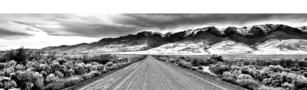
The Resort is 85 miles from Portland by way of Hood River. Take Interstate 84 east up the Columbia River Gorge to Hood River, then drive southwest to Dee and follow the signs to Lost Lake. From Portland you can take Mt. Hood Highway 26 to Zig Zag, turn left onto Lolo Pass Road and follow the signs to Lost Lake. This is a truly scenic route to the lake but it does have 4 miles of gravel road over the pass and many turns along the way before you reach the campground.
Lost Lake is generally accessible from mid-May until snow blocks the road, usually late October.

Oregon Photo Guide™ features the landscape photography of Michael Skourtes, Bend Oregon photographer and avid outdoorsman. I venture throughout the state searching for the top destinations for Oregon hiking, backpacking, camping, and photography. I share my experiences and photography of Oregon on my guide. I encourage you to explore Oregon and make your own outdoor adventure.