
 The Fall Mountain Lookout Cabin is a former Oregon Forest Service lookout built in 1933. Back in the day, before satellite surveillance technology, lookout personnel monitored the forest from this perch for signs of smoke, alerting fire guards at times of peril. The lookout is located approximately 14 miles southwest from John Day, Oregon on Fall Mountain in the Malheur National Forest. At an elevation of 5,949 feet, the approximately 25 foot high lookout tower offers 360-degree views of the Strawberry Mountain Wilderness, and the surrounding valley including the distant towns of Seneca and Mt. Vernon.
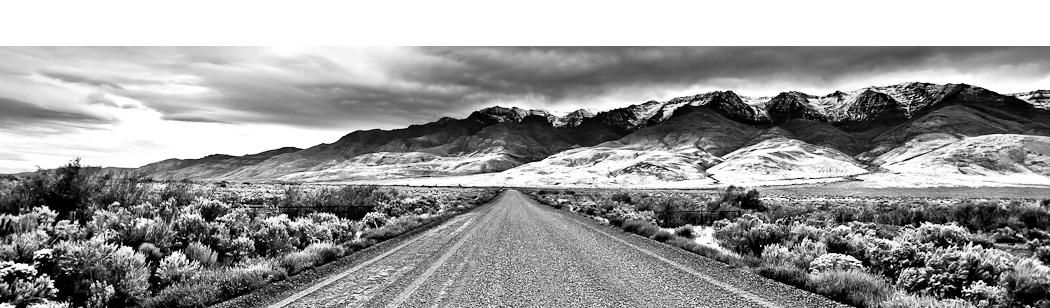
As this cabin is currently available for rental use through Recreation.Gov, I planned an overnight trip to the lookout cabin. It was the first week of October, and although Fall had just begun, it was surprising to experience weather that was reminscent of the middle of winter. Once the truck was above 4,000 feet there was a fairly respectable dusting of snow.  After reaching the lookout cabin at nearly 6,000 feet, the snow was steady and the temperature dropped down from 45 to 28 degrees. The drive to the Fall Mountain Lookout cabin can be reached along gravel forest roads by a passenger car all the way to the tower itself. However, in inclement weather, four-wheel drive is a must. Upon arrival at the lookout tower, the wind was howling and the snow was beating upon the tower’s steep and frozen steps to the cabin.
The Fall Mountain Lookout cabin is noted as the only recreational tower in Oregon to have electricity and certainly does have its comforts. The 14×14 foot cabin has a futon, table and chairs, electric heater, stove, and refrigerator. Two can sleep on the futon, but there is space on the cabin’s floor for a couple of sleeping bags. The lookout has glass windows on all four sides offering 360 degree views of the surrounding area and a catwalk on the outside of the cabin to walk around.  There is no water located at the facility or any water in the surrounding area. This is a “pack it in, pack it” out location. The Forest Service has built a very nice single person vault toilet (outhouse) within 50 feet of the cabin. Located a few distant yards from the lookout tower is an old shed and a couple of radio and electricity towers. Cell phone reception is crisp and clear thanks to a nearby cell tower.
The expansive Strawberry Mountain Wilderness and 125-plus miles of hiking trails are just a 30 minute drive from the lookout tower. The Strawberry Mountain Wilderness area comprises 69,350 acres, including many mountain peaks and several alpine lakes. The area is home to the Strawberry Mountain Range with the highest point being Strawberry Mountain at over 9,000 feet. A very popular hike and higly scenic route to reach the summit of Strawberry Mountain, is the 6.5 mile long hike from the Strawberry Basin. This route passes Strawberry Lake, Strawberry Falls and many meadows, ridges, and viewpoints along the way which are perfect to take a rest and photograph. This route to the summit of Strawberry Mountain starts at the Strawberry Campground. This campground is a convenient place to park your vehicle at the trailhead. The campground gets heavy use, especially in the peak Summer months, and Strawberry lake is popular for fishing and swimming.
The Fall Mountain Lookout cabin is an excellent base camp for hiking, fishing, hunting, or exploring the vast wilderness in the surrounding John Day area.  On a clear day, the lookout offers great views for photography and sightseeing and the 360-degree views from the tower are a perfect place to experience sunsets and sunrises, stargazing, and the many summer thunder and lightning shows that Eastern Oregon is well known for. Plus, the lookout cabin is like a giant tree house, and well, that has an appeal all its own.
To Get There:
From John Day, travel south approximately 11 miles on Highway 395 to Forest Service Road (FSR) 3920. Continue on FSR 3920 to the junction with FSR 4920 and turn right on FSR 4920. Travel less than ¼ of a mile and turn right onto FSR 492067. Follow FSR 492067 approximately 1 mile to the lookout where you can drive up to and park next to the tower. There are fairly easy to follow “Fall Mountain” signs along the way and passenger cars shouldn’t have a problem in optimal conditions. Anything beyond that, four-wheel drive is a must.

Oregon Photo Guide™ features the landscape photography of Michael Skourtes, Bend Oregon photographer and avid outdoorsman. I venture throughout the state searching for the top destinations for Oregon hiking, backpacking, camping, and photography. I share my experiences and photography of Oregon on my guide. I encourage you to explore Oregon and make your own outdoor adventure.