
The Aldrich Mountains outside of John Day in Eastern Oregon are part of the larger Blue Mountains range and are far less crowded then many of their popular Oregon counterparts. Yet, the Aldrich Mountains offer outdoor enthusiasts miles of hiking trails and spectacular views of the John Day basin. They are named after Oliver Aldrich, a pioneer who was killed by Native Americans in the Bannock War of 1878, on a nearby mountain which now bears his name. One of the most popular hikes in the Aldrich Mountains is the the hike to Fields Peak and Moore Mountain which offers prime views of the ranchlands and wilderness in the John Day area.
Sunrise on the John Day River 
Fields Peak, a former fire lookout spot, at an elevation of 7,362 feet is the highest point in Oregon between Strawberry Mountain and the Cascades. Being the highest point in the Aldrich Mountains, it offers fantastic panoramic views of the John Day Valley to the North and the Steens Mountains to the South. Fields Peak and the greater surrounding area is part of the Malheur National Forest but is an undesignated wilderness area. As the Aldrich Mountains are part of the much larger Blue Mountains, they are a component of one of the largest uplifts in Oregon. The Blue Mountains stretch from east of Prineville southeast to just north of Burns, east almost to Baker City, and north into Southeast Washington. The Blue Mountains consist of five sub-ranges. From west to east, these are the Ochoco, Aldrich, Strawberry, Greenhorn, and Elkhorn Mountains.
The hike begins at the McClellan Mountain Trailhead for a steady 2.3 mile climb to the summit of Fields Peak which gains just slightly over 1,800 feet in elevation. From Fields Peak however, you can hike the nearby peaks of Moore Mountain, Moon Mountain, McClellan Mountain, and Riley Mountain. This would make for a fairly long but not too strenuous day of peakbagging and taking in the expansive views.
 From atop Moore Mountain
Starting at the McClellan Mountain Trailhead which travels west up the trail to Fields Peak, the first half of the trail is easy to follow since it is used by horses and ATVs. After approximately 2 miles you reach a junction where you could continue going straight along the trail to Fields Peak or veer right and head over to Moore Mountain. At this exact point there is a wooden sign post with no name and nothing tacked to it. Opting to veer right and hiking less than a quarter of a mile to another wooden sign; you are standing before Moore Mountain.
From the Moore Mountain sign you can continue along the forested trail for approximately another quarter of a mile before reaching the backside of Moore Mountain. From here, it is a straightforward scramble up to the top for marvelous views of the surrounding valley. Moore Mountain at 7,060 feet is essentially a big smooth bump and is not really what you would think of as a “mountain.” So it is a fun peak to climb because it is completely visible for much of the hike and depending on your physical abilities there is probably no wrong way to scramble up the few hundred feet to the top. It is not very steep in grade and route finding is easy since it is well above the tree line.
Fields Peak from Moore Mt. 
After a short break, some photographs, and marveling over the 360 degree views, you can then make your own trail down the mountain and head over to Fields Peak from which you can easily spot from the summit of Moore. From Fields Peak you can continue down your original trail and make your way back to the McClellan Mountain Trailhead.
From the trailhead you can drive down the way you originally came to Billy Fields Campground on Fields Creek Road. This campground is certainly worth mentioning as it was one of the cleanest and most comfortable campsites in the area. There is no fee to use this campground and there are approximately 6-8 campsites with room for your car and tent. They each have a fire pit and grill, along with a picnic table. Fields Creek runs along the backside of the campground just a few yards away from the camp sites. It is not much of a picturesque creek as there is a lot of wild brush and trees obscuring most of it, but the ice cold running water is definitely nice to clean up a bit and cool off from the 100 degree heat.
The Aldrich Mountains are a top hiking and backpacking destination in Oregon because the scenery is unique and interesting due to the varied terrain and geological formations. In a relative short distance you go through pine trees, open grass fields, and small scrub and wildflowers; and then it is up a small scramble of one of the many peaks for breathtaking 360-degree views. Due to the views and the abundant wildlife there is no shortage of opportunities to take photographs. Great images can be taken on a day with picturesque clouds or a thunderstorm approaching. The drive to Dayville takes you through one of the most scenic Oregon Byways as it meanders through the John Day Fossil Beds. There are also many scattered old homesteads and barns in the area which are popular to photograph. This is rugged pioneer country and epitomizes Eastern Oregon. I encourage you to explore Oregon and make your own adventure.
To Get There:
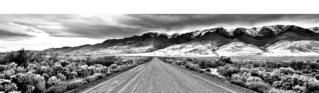
From Portland, take Highway 26 east to approximately 13 miles outside of Dayville. Turn south on Fields Creek Road. Continue along this well-paved road approximately 8 miles to a sign for Fields Peak and Road 115 where now the road becomes gravel/dirt. Turn left on this road and go about a quarter of a mile to a “T” in the road. Now turn right on Road 2160 for 100 yards and then turn left on Road 41. The road becomes fairly steep and rough so 4-wheel drive is recommended.
Continue along the road for less than a mile until you reach the end of the road. From here there is a wooden sign which reads “McClellan Trail.” There is a turnaround and room for cars and horse trailers. The trailhead sign had nothing posted on it when I was there noting the trails or which direction to go. While facing the sign, on your right is the trail to McClellan Mountain. To your left is the trail to Fields Peak which is what I took. There is plenty of space to find your own camp spot in the surrounding area at the trailhead. There is no water available so be sure to bring your own supplies and check the weather forecast.

Oregon Photo Guide™ features the landscape photography of Michael Skourtes, Bend Oregon photographer and avid outdoorsman. I venture throughout the state searching for the top destinations for Oregon hiking, backpacking, camping, and photography. I share my experiences and photography of Oregon on my guide. I encourage you to explore Oregon and make your own outdoor adventure.